Activity
Mon
Wed
Fri
Sun
Mar
Apr
May
Jun
Jul
Aug
Sep
Oct
Nov
Dec
Jan
Feb
What is this?
Less
More
Memberships
Mammoth Mountain Snowman
356 members • Free
24 contributions to Mammoth Mountain Snowman
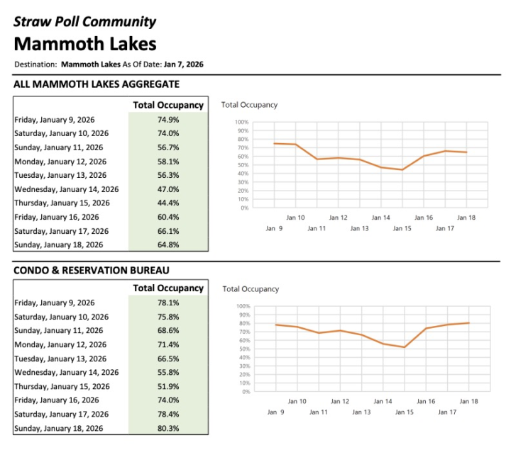
Jan 7 •
Weekend Occupancy
My little one starts her Mountain Ranger camp this weekend so we'll be making the trek. See you in line 🤣

2 likes • Jan 15
M-Th are the days to be there!🤘🏻
Jan 6 •
How long have these things been around?
First time I’ve ever heard of a “line expediter day pass”. 🤯🤯
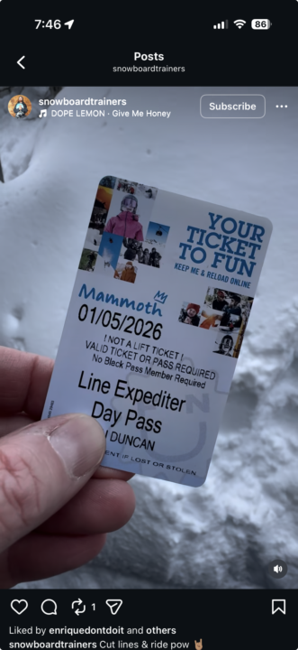
0 likes • Jan 6
Oh wow I wonder how much that costs? Never seen one either
2 likes • Jan 9
Where do you get friends who have the black pass??🤣🤙🏻
Jan 1 •
Happy New Year!
Happy New Year everyone. Here's to a long and fun ski season! Watching the heavy snowfall on the Mammoth cams right now -- a good start to 2026.
1 like • Jan 2
Happy New Year!🤙🏻
Dec '25 •
Mammoth is Closed Today due to Avalanche Risk
Message on Mammoth's site: All mountain operations are suspended today due to high avalanche danger. Wow.
1 like • Dec '25
Me too! Typical social. Some people say so. Others say no. I’ll just keep it quiet till I know more. Don’t want to add more stress or disinformation to the sad situation.
0 likes • Dec '25
Looks like people/employees reporting the Mtn will be closed tomorrow as well the 27th due to ongoing Avy mitigation. Probably a good call. You can just barely see the top of the totem pole on the summit view of the cam today.
Dec '25 •
RIP, Olancha?
Now that 395 bypasses Olancha, is it destined to become another Inyo county ghost town? Other than the Jerky store and the Mobil station, there was never much there to begin with. I remember the old diner, but that closed years ago. Back in the 00s, the Mobil station used to be my first stop for gas when making the drive north.
1 like • Dec '25
Cool! I bet they are, I wouldn’t be either. I don’t like the detour even though it’s safer smoother and faster. But that just means you get a nicer view and closer to the Mtn too.
0 likes • Dec '25
Always wondered about ‘Lake Olancha Resort’ They built that huge half circular wall and started putting pictures on it. I was never able to see from road, but recently saw on Google Maps and can now see what looks like a waterski type shape lake w rv sites on the backside. It will blow up at some point I’m sure.
1-10 of 24
@john-roddenberry-6673
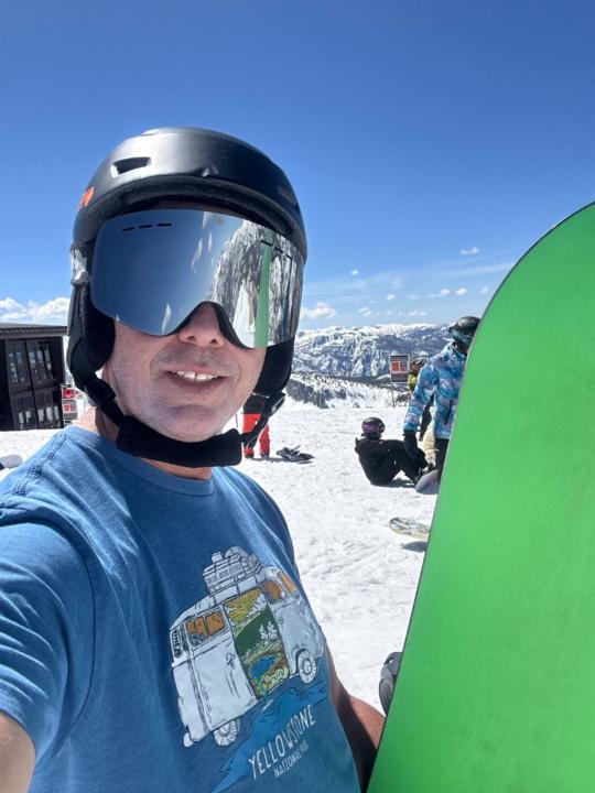
Accomplished painting contractor, snowboard since ‘86, hiked Mt Whitney in ‘24, MTB regular w/kids on school team.
Active 6h ago
Joined Apr 5, 2025
Powered by