Activity
Mon
Wed
Fri
Sun
Jun
Jul
Aug
Sep
Oct
Nov
Dec
Jan
Feb
Mar
Apr
May
What is this?
Less
More
Owned by Steve
Learn Bigfoot Research techniques. A community with encounters, field tips,mapping hotspots, gear advice, & learn how to explore the outdoors safely.
GIS Answers is a community for GIS Users to learn, collaborate, and discuss Geographic Information Systems. Access to information on GIS Software.
Memberships
Camping Wilderness Skool
178 members • Free
Skoolers
188.2k members • Free
1 contribution to Camping Wilderness Skool

Jan 7 •
🔥START HERE — DO THIS FIRST 🧭
Glad you're here. This community runs on field calls, not gear flex. 👆 ✅ Your First Win (60 seconds): Drop ONE line in the comments: 👉 Terrain type for your next 48 hours (woods / river corridor / mountains / desert / mixed) That's it. I'll reply with one steady fix to tighten your next trip. 🔥 🎯 Your First Milestone (within 7 days): Post your One-Screen 48-Hour Trip Plan (no locations): Not sure what some of these mean yet? That's exactly why you're here. Best guess is fine. - Terrain type - Time of year - Expected low temp - Sleep system (bag/quilt + pad) - Cook system (yes/no + stove type) - Water plan (filter/chemical/boil) - Pack weight estimate - #1 concern Keep it plain. Keep it honest. That's how you get better fast. 🤙 Drop your ONE line below. 👇 Where the Map Ends, The WILD begins!! Stay Rugged.
1 like • 3h
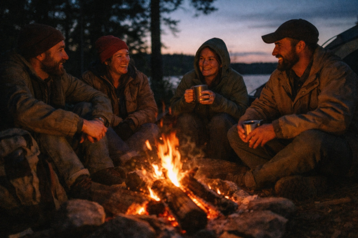
I’ll be camping and in a rustic cabin this summer near Algonquin Park. Hiking and fishing in a remote park with mixed heavily wooded terrain with lots of lakes and swamps. Looking to learn some camp cooking. Any mosquito repellent tips/hacks I would try out!
1-1 of 1

@steve-whitehead-8844
Steve is a GIS Mapping Professional with 30 years of experience. He has 15 years of experience in the Bigfoot/Sasquatch research.
Active 3h ago
Joined May 17, 2026
Powered by