Activity
Mon
Wed
Fri
Sun
Aug
Sep
Oct
Nov
Dec
Jan
Feb
Mar
Apr
May
Jun
Jul
What is this?
Less
More
Memberships
Agriculture Mapping School
77 members • Free
2 contributions to Agriculture Mapping School
Jun '25 •
Relative Elevation in Ag
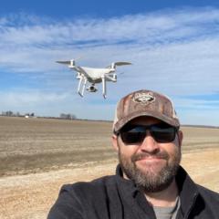
Agriculture Elevation Mapping for irrigation, drainage, and even landforming is all operated off of relative elevation. A base is set on an unknown point around the field being mapped. From there a rover collects elevation or provides a reading relative to the bases location. This practice is commonly used through ground marking/surveying; however with a drone you need real world horizontal accuracy without the need of real world vertical (MSL) which is the common purpose of ground control points (GCPs). The “Hybrid” method as I like to coin it is setting a base location using NTRIP corrections prior to flight with a EMLID receiver or doing a PPK method of processing. How relative can the base be? I’ve collected elevation on over 90,000 Acres across 3 years doing this right here!

1 like • Jun '25
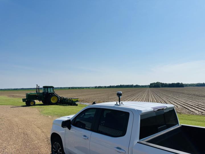
Production side. Crops: Corn, Wheat, Soybeans, Sunflower, Barley. Fields are between 30 ha - 100 ha.
2 likes • Jun '25
When 4 G coverage is reliable, I fix my base station by RTK; otherwise, I record raw data and run a PPK solution against the nearest CORS station. About 30 minutes of observation is usually enough to obtain centimeter-level absolute coordinates. With the base established, I use the rover to survey 5–10 aerial GCP targets distributed around the site. After the mapping flight, I process everything in the office: the rover observations are post-processed against the fixed base in Emlid Studio, and the corrected GCP coordinates are imported into Agisoft Metashape for photogrammetry, following the USGS workflow in this guide (don't get confused about the name) https://pubs.usgs.gov/publication/ofr20211039 My clients run a mix of guidance systems—John Deere SF3, RTK, Trimble, and others. Because their operators choose harvest or seeding directions on the fly (there’s no controlled-traffic farming), they don’t request pre-defined guidance lines. Contour lines alone are usually sufficient for their needs. For variable-rate seeding and fertilizer, however, I must derive slope maps and plant-available-water estimates, so the high-accuracy elevation model is the cornerstone product. All subsequent agronomic layers are generated from that DEM.
Jun '25 •
Welcome! Introduce yourself + share a pic of your technology🎉
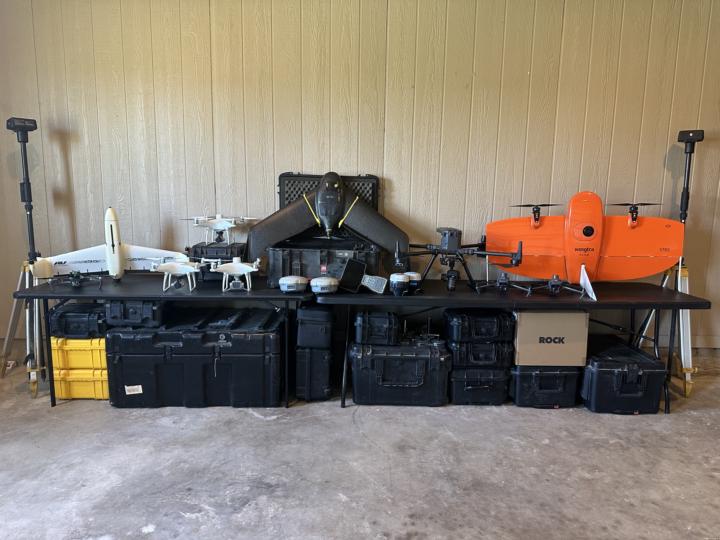
Let's get to know each other! Comment below sharing where you are in the world, a photo of your technology, and how you use it to make money weekly. 😊 This group aims to introduce innovative methods for enhancing efficiency and precision in agriculture through the use of drone technology. The majority of classwork and discussions will focus on elevation and its applications in agricultural practices. Additionally, you will learn about various GPS technologies, mapping capabilities, and how to be a well-rounded Agriculture Mapping Technician, providing essential services in your agricultural communities in the future. Below is a picture of all my drone technology from 2019 to the present, all of which has been used exclusively for agricultural purposes.
1 like • Jun '25
6 year experience. My field of work is precision agriculture. Self-taught in QGIS, SAGA and R. Using ardusimple F9P GPS to do mapping works, and a phantom 3 Advance for drone mapping. Currently forced to use Maps made easy apps as flight planning because dronedeploy or Pix4D Capture Pro left behind my drone years ago.
1 like • Jun '25
I would love to get a RTK drone with better optics, but buying technology is too expensive around here (Argentina), so ROI of equipment is extremely low.
1-2 of 2
@juan-ignacio-pucheu-8195
Gis specialist working in Argentina. Precision agriculture, and farm iot
Active 391d ago
Joined Jun 8, 2025
Powered by